| WHY IS IT CALLED "THE
FISH AND BOWL"? |
|
| WHY CSFB
"2.1"? |
CLICK
ON
PHOTOS BELOW
TO ENLARGE..
|
|
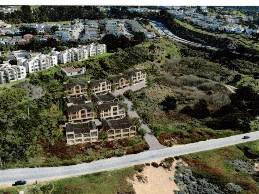
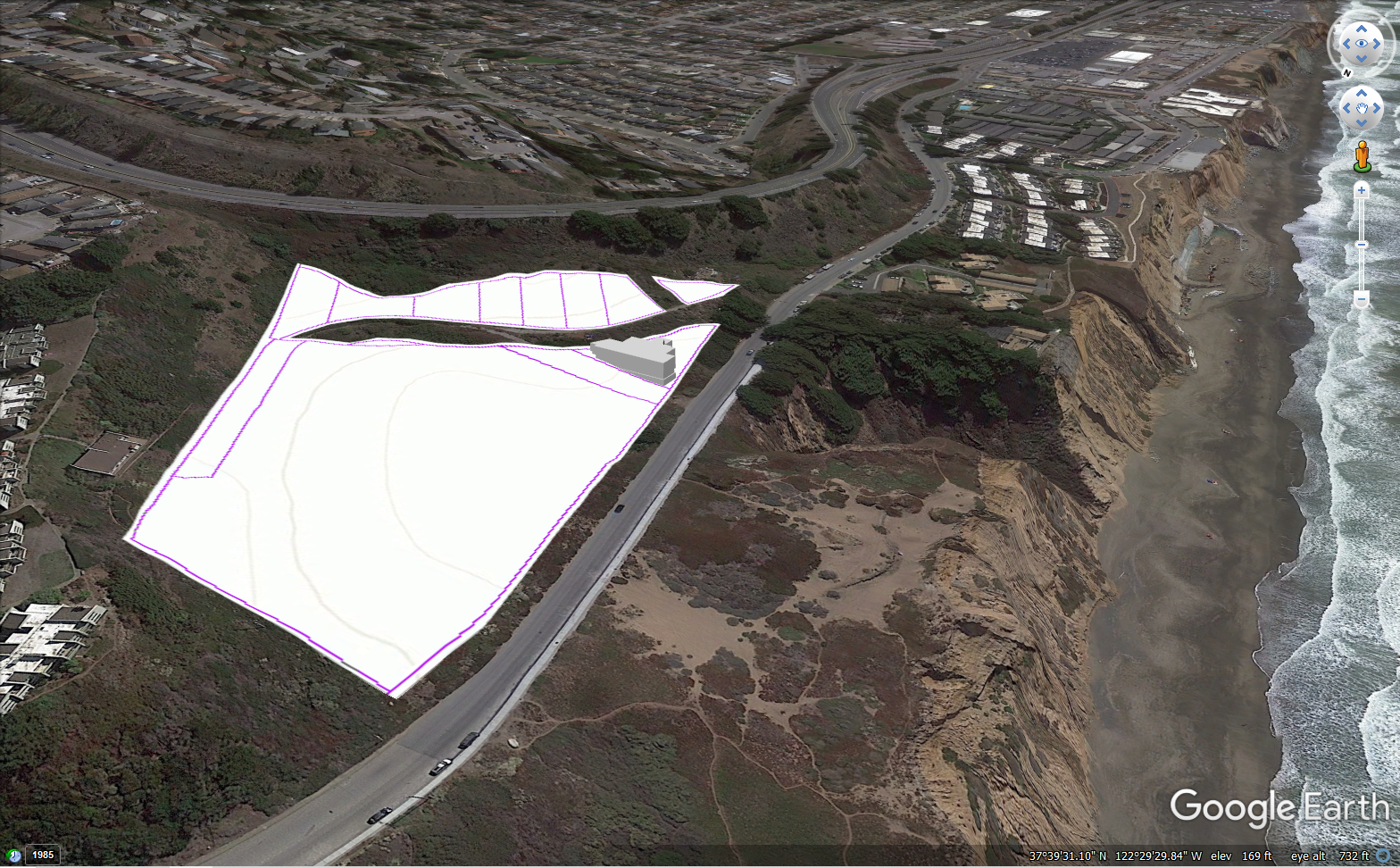
. 20 unit condominium complex in Bowl parcel
click
>
for
architectural
drawing
|
|
| .
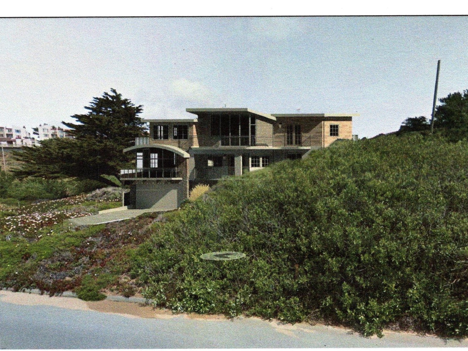
4 unit apartment building in triangular parcel just
below Fish parcels
click
> for
architectural
drawing
click
> proposed location in Fish and Bowl
|
 |
|
| The
zoning is is very important. The Bowl shaped single lot is zoned 'medium
density' allowing for 8-10 units per acre. Fish shaped set of lots are
zoned for a lower density allowing for far fewer units per acre. |
| 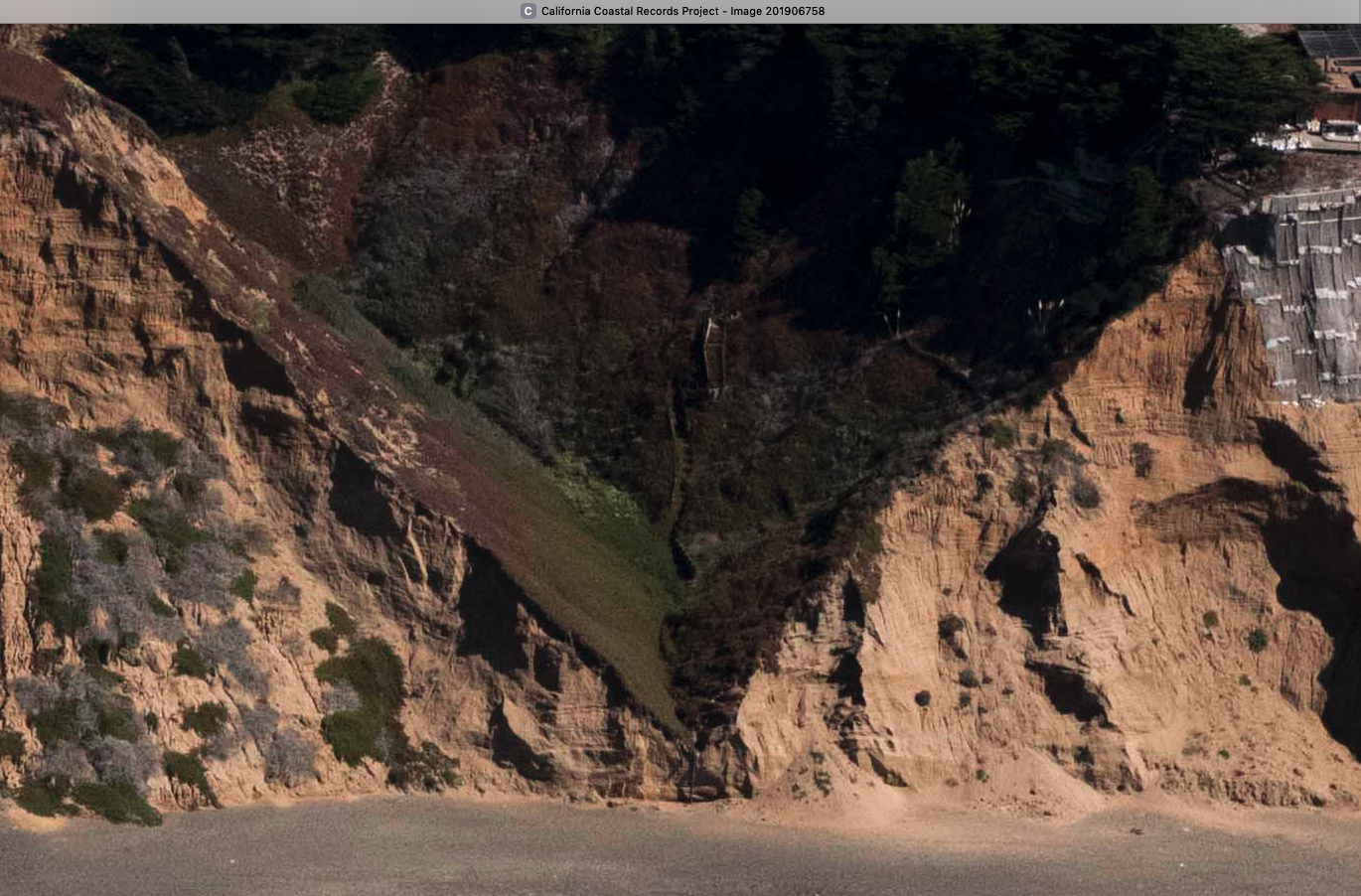
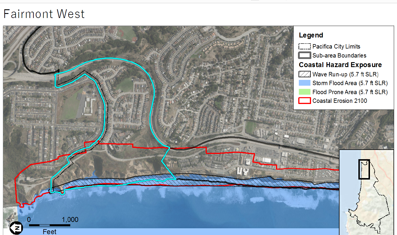
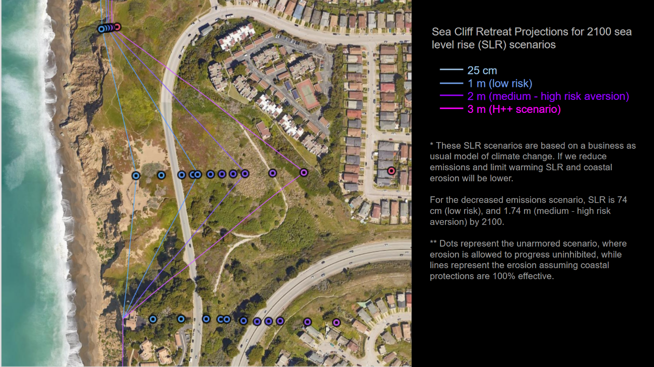
This
deep ravine is now within
a few feet of Palmetto Avenue.
- Click here to see more photos of ravine.
- Click
here
to see it w/ Google Earth.
|
If this ravine erodes any
further eastward it will sever Palmetto
Avenue and cut off most of West Fairmont from the
Manor District and south (see Year 2100 "red line").
Long before that Palmetto Avenue will need
to be relocated eastward (see shorter term erosion projection).
Click here to see the coastal erosion back to the 1960s |
|
Click to enlarge >>
|
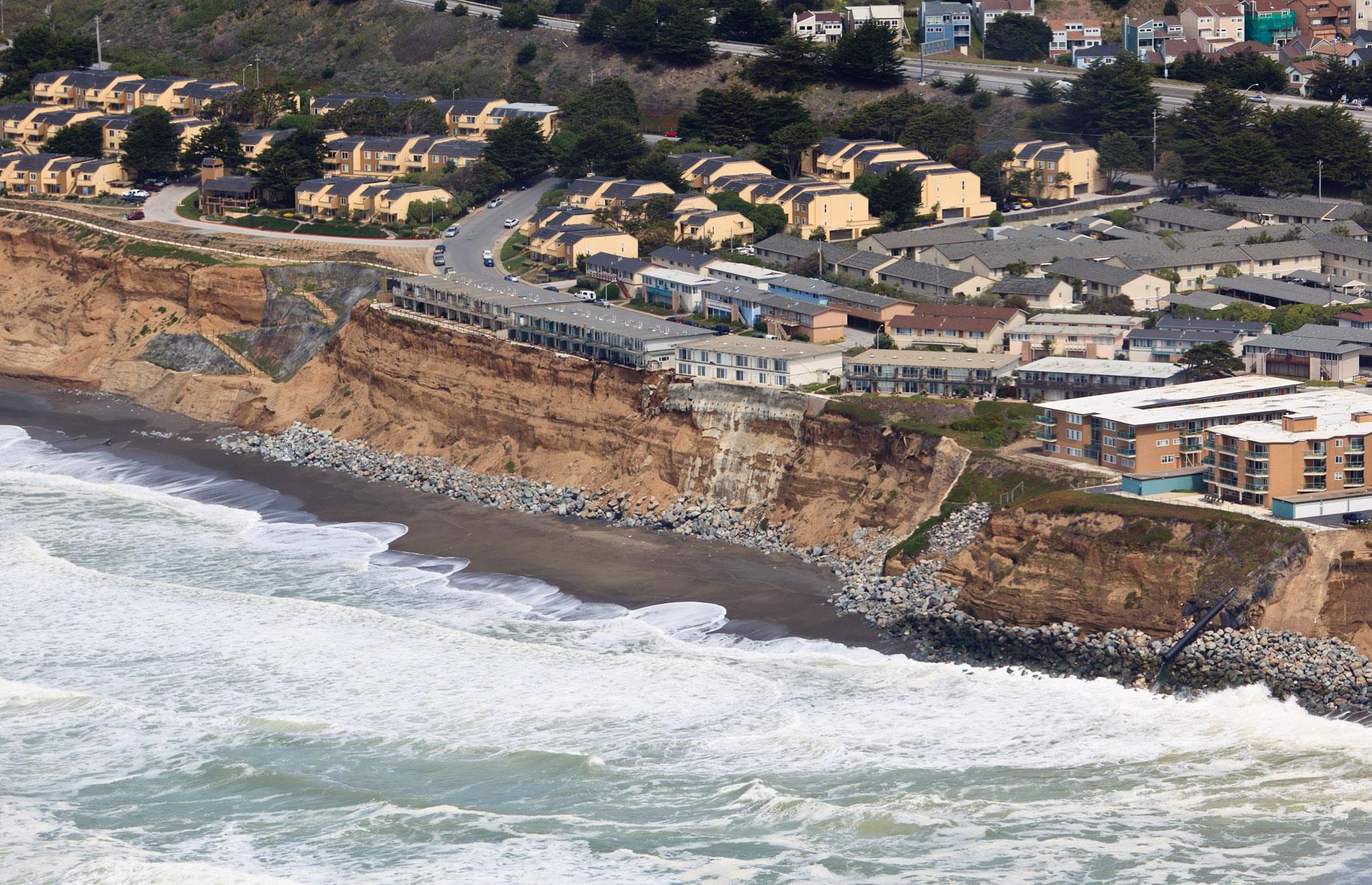 Esplanade Avenue, Pacifica CA Esplanade Avenue, Pacifica CA
|
|
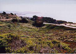
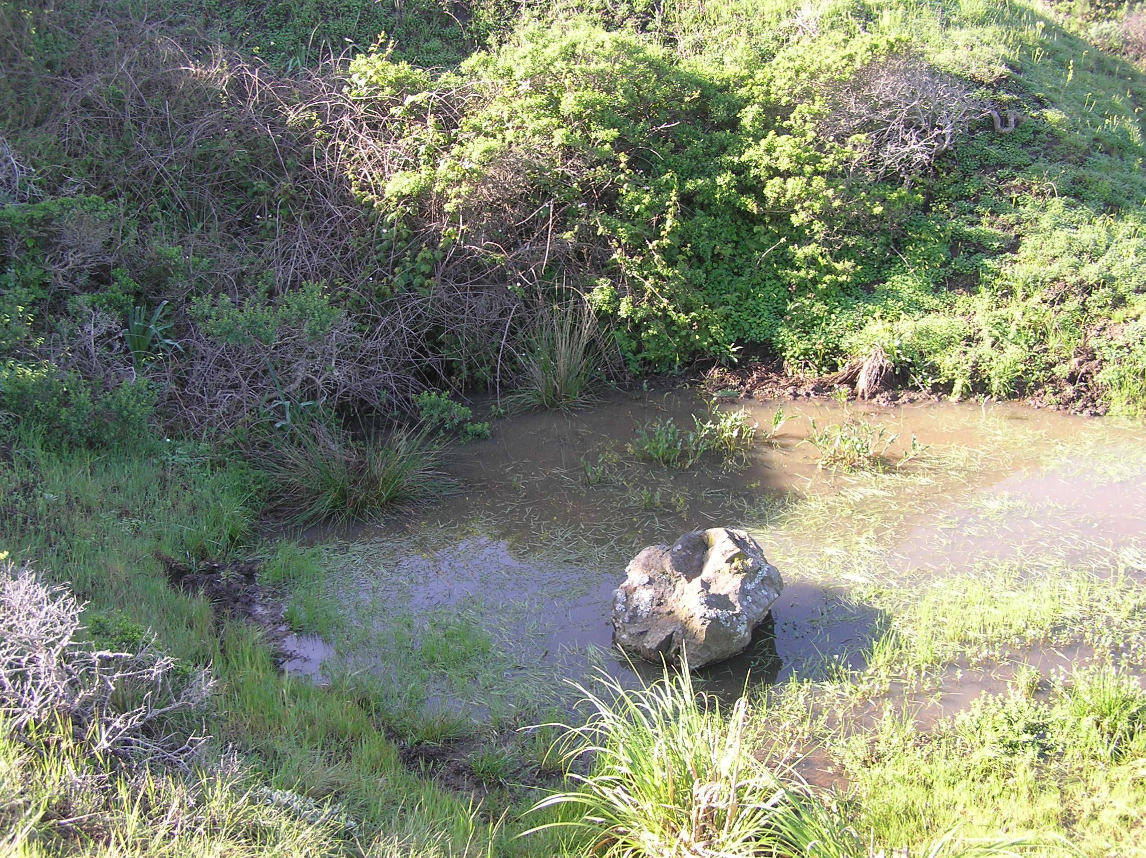
| Much of the
Fish and Bowl area has a near to the surface water table that supports large patches
of willows, an indicator species of a seasonal wetland areas. |
|
|
These
draft
documents reflect the City's unfinished work on
sea level rise issues as well as work on the State required
update to the General
Plan (GP) and
Local Coastal Plan (LCP). The current. and
still legally binding versions date back to 1980.
The Calif Coastal Commission funded the update to the
LCP but it has yet to accept the City's draft.
|
| .
|
Here
is
easy access to the three most important
documents concerning land use in Pacifica.
Although dated (1980) in terms of present
day concerns and issues, they nevertheless, are
the law. Both the Local Coastal Land Use Plan and the
General Plan which incorporates it are in the
process of being updated. ( see above).
|
| |
|
|
|
|